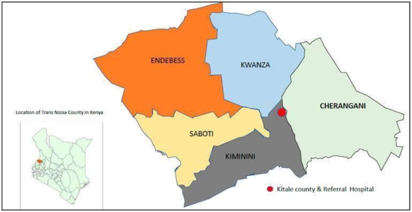
Kiminini urban growth reflects a powerful transition from a colonial outpost called Elgon Club to a vibrant commercial and administrative town in Trans Nzoia County. Situated along the Kitale–Webuye highway, Kiminini has rapidly expanded due to increased trade, population growth, and agricultural activity, making it the second-largest town in the county after Kitale. Despite these advancements, it continues to face planning challenges, infrastructure deficits, and land use pressures.
Originally dominated by white settler estates in the pre-independence era, the land in Kiminini changed hands post-independence to local African buyers who subdivided it, leading to intense fragmentation. This shift significantly altered its agricultural productivity and laid the groundwork for an uncoordinated sprawl. Today, the area has transitioned into a semi-planned urban hub, housing key institutions, educational centers, religious sites, and active marketplaces. Yet, the absence of an approved development plan and clear zoning guidelines continues to constrain its sustainable development.
Historical Transition: From Elgon Club to Kiminini Town
Era
Description
Colonial Period
Elgon Club established for white settlers; land used for large-scale farming
Post-Independence
African elites acquired land, subdivided it for residential and commercial use
Present Day
Kiminini is a densely populated urban hub serving as Sub-county HQ
Key Growth Drivers of Kiminini
Factor
Contribution to Growth
Agriculture
Attracted traders; key economic base despite land fragmentation
Location
Proximity to Kitale, highway access boosted trade and migration
Education and Institutions
Presence of schools, polytechnic, and government offices
Political Engagement
Active local leadership and community participation in governance
Infrastructure Investment
Road expansion, street lights, bus stage development
Urbanization Challenges
Challenge
Impact
Lack of Physical Plan
Unregulated expansion and land-use conflicts
Poor Waste Management
Health and sanitation issues due to informal disposal
Insufficient Housing
Inadequate rental units and limited infrastructure in settlements
Green Space Deficit
Absence of public parks and recreational facilities
Inadequate Transport Network
Impassable roads in rainy seasons; no sidewalks for non-motorized traffic
Residential Patterns and Land Use
Residential Area
Characteristics
Masaba A & B
Mixed-income housing; Masaba A less congested with better access to clean water
Muthangari
Low-income area; lacks sewer, roads, and street lighting
Kananachi
Sparsely populated; better access to borehole water but poor road quality
Market Center
Electrified; better access roads but lacks piped water and sewer system
Conclusion
Kiminini’s urban transformation showcases the dynamic interplay between history, agriculture, population growth, and devolution. As a town on the cusp of official classification, it holds immense potential to be a model for sustainable urban development in rural Kenya. Realizing this vision will require robust planning, improved public services, and active community participation to turn Kiminini into a resilient and inclusive urban hub.
Nyongesa Sande offers diverse content across news, technology, entertainment, and more, aiming to provide readers with a wide range of informative and engaging articles. NYONGESA SANDE's dedicated team provides our audience not only with the highly relevant news but also with outstanding interactive experience.