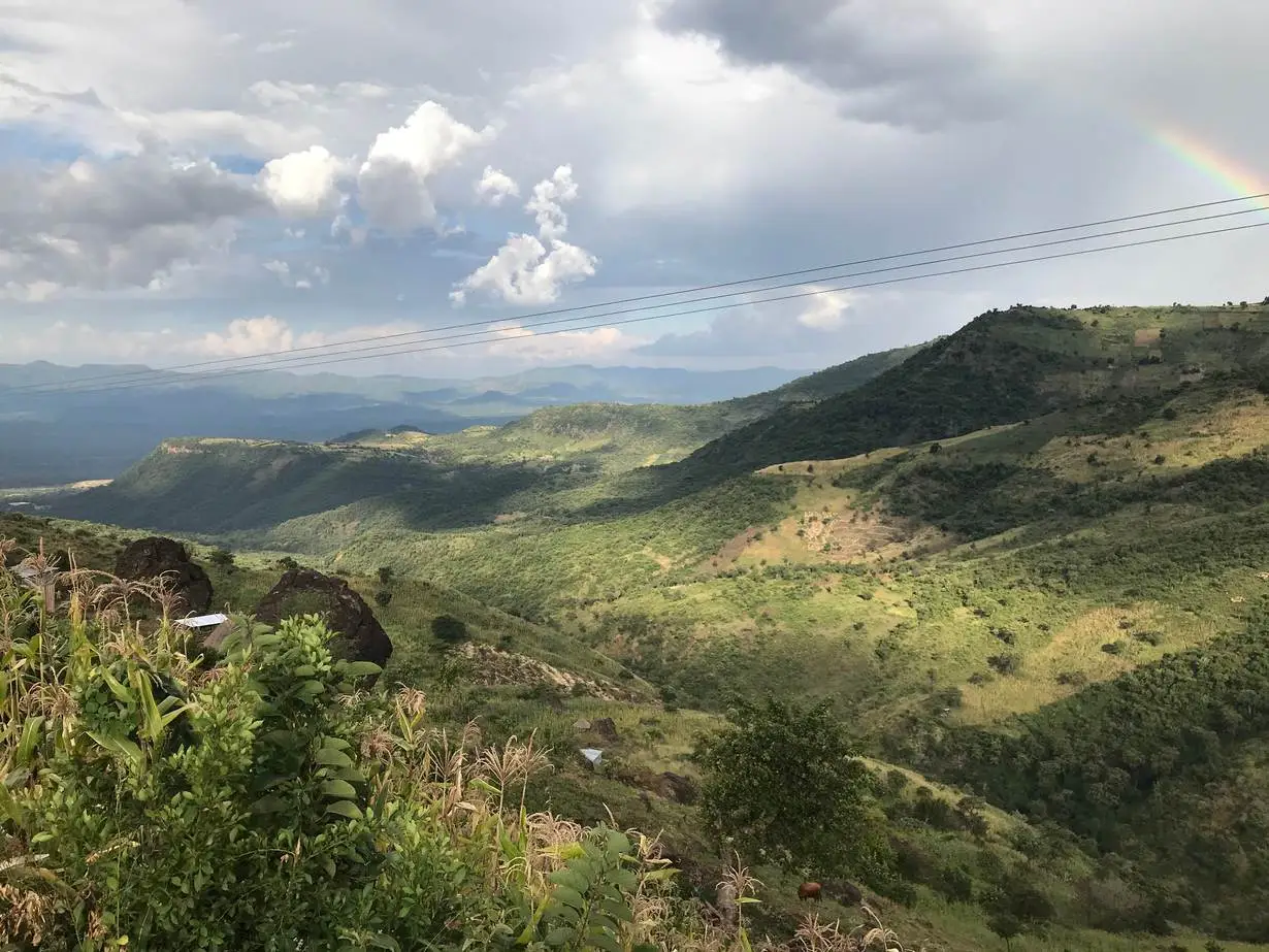
Rising dramatically at the southern boundary of Elgeyo Marakwet County, the Metkei Ridge is one of the most striking natural features linking the highlands of Baringo and the Great Rift Valley. Towering to elevations of up to 3,500 meters, this heavily wooded and rugged ridge forms a breathtaking skyline, its slopes deeply etched by gullies and ravines that tell the story of centuries of erosion and tectonic uplift.
The ridge marks the southern end of Elgeyo Marakwet and acts as a scenic frontier with Baringo County, best admired from the Nyaru–Kabarnet Road or the C51 Eldama Ravine–Nyaru–Eldoret Road. Its dense Metkei Forest, shrouded in mist and mystery, remains largely inaccessible—an untouched wilderness that guards the source of the Kerio River. From this high point, the land cascades dramatically through a series of steep slopes and rolling plateaus that make up the Elgeyo Escarpment, finally giving way to the vast openness of the Kerio Valley, which lies about 1,000 meters above sea level.
For nature enthusiasts, geographers, and photographers, Metkei Ridge presents a stunning tableau of vertical landscapes, where dense forests meet plunging cliffs, and sunlight plays off the deep gullies to create breathtaking contrasts. The area is also rich in biodiversity, with native vegetation and bird species thriving in the cool, mist-laden heights.
Though off the main tourist trail, the Metkei Ridge offers a rewarding detour for those exploring the Rift Valley’s less-travelled frontiers. Its raw natural beauty, geological drama, and serene isolation make it one of Kenya’s most compelling hidden gems—a place where one can truly grasp the magnitude and majesty of the Rift Valley’s sculpted terrain.


