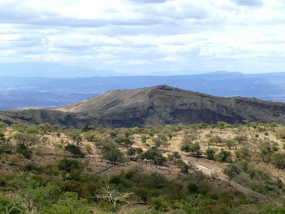
Rising dramatically between Lake Baringo and Kapedo Falls, the Paka Volcano Hills form one of Baringo County’s most striking geological features. This majestic cone-shaped volcanic complex, located near Kenya’s northern border with Turkana County, is surrounded by a cluster of smaller volcanic cones and fissures that bear witness to the powerful forces that have shaped the Great Rift Valley.
At its summit lies a 1.5-kilometer-long caldera, the heart of the volcano and a defining feature that gives Paka its distinctive topography. The name Paka—derived from the Pokot word for “ochre”—aptly reflects the region’s characteristic reddish volcanic dust that swirls intensely between January and March, painting the landscape in warm earthy hues. The volcano’s terrain is rugged and remote, exuding an almost otherworldly beauty that captivates adventurers, geologists, and photographers alike.
Paka Volcano is part of a chain of nine major axial volcanoes that define the northern Kenyan Rift. Alongside Silali, Korosi, Emuruangogolak, Namarunu, Barrier, Andrew’s Cone, Chepchuk, and the Lake Turkana Islands, it forms a unique volcanic belt that extends northward through Kenya’s Rift Valley. The area around Paka still exhibits geothermal activity, with fumaroles, steaming vents, and warm springs offering glimpses into the earth’s immense geothermal potential.
Located 25 kilometers north of Lake Baringo and 15 kilometers east of Nginyang’ Village, the Paka Hills are best explored by seasoned travelers and researchers seeking untamed wilderness. The region’s isolation, stark volcanic beauty, and sweeping Rift Valley panoramas make it one of Kenya’s most underrated natural wonders—a true frontier of adventure and discovery.
Whether viewed from the air or trekked on foot, Paka Volcano tells a timeless story of creation, endurance, and natural power—a living monument to the earth’s fiery heart still pulsing beneath Baringo’s northern horizons.


