


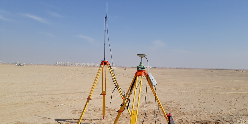
The best land survey companies in the UAE provide the measurements, maps and geospatial information required to plan, design and construct buildings, roads, utilities and major infrastructure.
A land survey establishes the physical characteristics of a site. Depending on the assignment, surveyors may identify plot boundaries, ground elevations, buildings, roads, drainage structures, utilities and other natural or constructed features.
Land surveyors also support active construction projects. They establish reference points, transfer approved designs onto the ground, monitor structural movement and record the final location of completed work.
Accuracy is essential. A surveying error can place a building in the wrong location, cause roads or pipelines to conflict with existing infrastructure, produce incorrect excavation quantities or delay approval from the relevant authority.
Modern UAE land survey companies use equipment including total stations, digital levels, Global Navigation Satellite System receivers, drones, mobile-mapping platforms and three-dimensional laser scanners.
The correct company depends on the service required. A villa owner may need a boundary or level survey, while an infrastructure contractor may require dedicated survey crews, utility mapping, road alignment surveys and continuous construction setting out.
This guide presents established companies offering land, topographic, engineering and geospatial surveying services in the UAE.
The firms are not ranked strictly from best to worst. Clients should verify current licences, municipal approvals, insurance, technical personnel and authority acceptance before appointing any surveyor.
1. Land Surveying Industry in the UAE
Land surveying supports almost every stage of property and infrastructure development in the UAE.
Surveyors may become involved before design begins and remain on the project until construction is completed and the final as-built information has been approved.
Dubai Municipality operates a dedicated Survey Department and provides services connected to surveying assessments and Dubai’s virtual reference system. Dubai also regulates land-surveying work through Law No. 6 of 2017.
In Abu Dhabi, land surveyors must comply with the cadastral standards and legislation in force in the Emirate. Regulations require survey reports to explain the tools and methods used, identify the documents relied upon and be formally sealed and adopted.
These requirements make it important to appoint a firm that understands both surveying technology and the procedures of the relevant Emirate.
Topographic surveying
A topographic survey records the natural and constructed features of a site.
It may identify:
- Ground levels
- Contours
- Buildings
- Roads and pavements
- Boundary references
- Walls and fences
- Drainage structures
- Utility covers
- Trees and vegetation
- Embankments and channels
Architects and engineers use this information to prepare designs that reflect actual site conditions.
Boundary surveying
A boundary survey identifies the approved limits of a plot.
The surveyor may compare field measurements with title information, cadastral maps, official coordinates and previously established boundary markers.
Boundary surveys are important before:
- Purchasing land
- Constructing boundary walls
- Starting a building
- Dividing a property
- Resolving an encroachment concern
- Installing infrastructure near plot limits
A boundary survey should not be treated as an informal measurement. The survey company must use the official documentation and coordinate system accepted by the relevant authority.
Construction surveying
Construction surveying transfers approved design information onto the site.
Surveyors may establish:
- Building corners
- Foundation positions
- Column grids
- Road centre lines
- Pipeline routes
- Finished floor levels
- Excavation limits
- Structural elevations
- Utility locations
Surveyors also check construction as it progresses to identify deviations before they become expensive to correct.
As-built surveying
An as-built survey records the final location, elevation and dimensions of completed work.
The survey may cover:
- Buildings
- Roads
- Drainage systems
- Pipelines
- Manholes
- Street lighting
- Utility chambers
- Landscaping
- Marine structures
As-built information may be required for completion approval, handover, asset management and future maintenance.
Utility surveying
Utility surveys identify visible and underground infrastructure.
Depending on the scope and site conditions, the surveyor may use:
- Existing utility records
- Total stations
- GNSS equipment
- Ground-penetrating radar
- Electromagnetic cable locators
- Trial holes
- Manhole inspections
Utility information helps reduce the risk of damaging active electricity, water, telecommunications, drainage or sewerage networks during excavation.
Drone surveying
Drones can collect high-resolution aerial imagery and geospatial information over large or difficult-to-access sites.
Common applications include:
- Large topographic surveys
- Construction monitoring
- Corridor mapping
- Stockpile measurement
- Quarry surveys
- Earthwork calculations
- Digital terrain models
- Progress photography
Drone surveying does not eliminate the need for ground control or professional checking. The surveyor must select appropriate flight parameters, control points and processing methods.
Three-dimensional laser scanning
Laser scanners capture large numbers of spatial points representing the surfaces of buildings, structures and terrain.
The resulting point cloud can support:
- Existing-condition documentation
- Scan-to-BIM
- Industrial plant modelling
- Dimensional verification
- Façade surveys
- Bridge surveys
- Structural monitoring
- Renovation planning
The technology is particularly useful for complex structures where conventional manual measurement would be slow or incomplete.
2. Best Land Survey Companies in the UAE
The following firms provide documented land, topographic, construction or geospatial surveying services in the UAE.
1. Accurate Survey Engineering
Accurate Survey Engineering provides land, engineering and geospatial surveying services from offices serving Dubai, Abu Dhabi, Sharjah and other parts of the UAE.
Overview
The company works with developers, contractors, consultants, architects and infrastructure organisations.
It states that it has more than two decades of UAE surveying experience and offers conventional field surveys alongside newer digital data-capture technologies.
Land-surveying services
Accurate Survey Engineering offers:
- Topographic surveys
- Boundary and cadastral surveys
- Construction setting out
- As-built surveys
- Elevation surveys
- Gate-level surveys
- Route surveys
- Underground utility surveys
- Earthwork-volume calculations
- Survey crew provision
Its topographic services use technologies including GNSS equipment, total stations, drones, GIS platforms and 3D laser scanners.
Topographic surveys
The company’s topographic deliverables can include ground elevations, contours, buildings, roads, drainage systems, utilities, vegetation and existing infrastructure.
This information can be used for architectural planning, grading design, roads, drainage, industrial sites and major infrastructure.
Utility detection
Accurate Survey Engineering provides underground utility detection using tools such as ground-penetrating radar and cable locators.
This can support excavation planning and help contractors reduce the risk of striking buried services.
Advanced surveying technologies
The company also provides:
- Aerial drone surveys
- Mobile mapping
- 3D laser scanning
- GIS mapping
- Scan-to-BIM
- Cut-and-fill analysis
- Bathymetric surveys
Its published service portfolio combines traditional land surveying with digital modelling and geospatial data management.
Why choose Accurate Survey Engineering
The company may be suitable when a project requires several survey methods from one provider.
Its combination of field crews, utility detection, aerial mapping and laser scanning can support projects from initial site investigation through construction and final documentation.
Best for
Accurate Survey Engineering may be considered for:
- Topographic surveys
- Construction setting out
- Boundary surveys
- Utility mapping
- Drone surveys
- Mobile mapping
- As-built documentation
- Scan-to-BIM projects
2. Falcon Survey Engineering Consultants
Falcon Survey Engineering Consultants is an established UAE surveying and geospatial firm.
The company says it was founded in 2007 and provides services involving land surveys, mobile mapping, drone surveys and laser scanning.
Overview
Falcon Survey works across construction, property, infrastructure, oil and gas, utilities and marine projects.
Its services range from conventional land measurements to aerial mapping and advanced three-dimensional data capture.
Land-surveying services
Falcon Survey provides:
- Topographic surveys
- Boundary surveys
- Construction layouts
- Subdivision surveys
- Title surveys
- Pipeline surveys
- Road surveys
- Oil and gas well-location surveys
- As-built surveys
- Mapping and digitisation
The company’s land-survey service specifically lists construction layouts, boundaries, topographic work, subdivision design and pipeline surveying.
Topographic surveying
Falcon Survey’s topographic surveys can record:
- Buildings and their heights
- Ground levels
- Contours
- Trees
- Fences and walls
- Roads
- Drainage covers
- Utilities
- Embankments
- Surface materials
The firm can deliver information in formats compatible with CAD, Revit and GIS platforms.
Construction surveying
Falcon provides construction staking, layouts and survey controls for projects using conventional or machine-guided construction methods.
Construction-survey support can continue from initial excavation through foundations, structural works, infrastructure installation and final as-built recording.
Drone and aerial mapping
The company’s aerial-mapping services support:
- Corridor mapping
- Large topographic surveys
- Highway construction
- Construction monitoring
- Contour mapping
- Excavation analysis
- Stockpile volumes
- Digital terrain models
Falcon states that drone surveys can reduce field time and provide high-resolution geospatial information for construction, infrastructure and land development.
Why choose Falcon Survey
Falcon may be appropriate for projects requiring both conventional ground surveying and advanced aerial or laser-scanning services.
Its range is relevant to buildings, roads, infrastructure corridors, utilities and large development sites.
Best for
Falcon Survey may be considered for:
- Construction surveys
- Topographic mapping
- Boundary demarcation
- Road and pipeline surveys
- Drone mapping
- Mobile mapping
- 3D laser scanning
- Large infrastructure projects
3. EIWAA Consultancy
EIWAA Consultancy provides engineering surveying, 3D scanning, BIM and inspection services across the UAE.
Overview
The company serves construction, architecture, infrastructure, industrial and oil-and-gas projects.
It combines conventional field-surveying methods with terrestrial laser scanning, LiDAR, photogrammetry and digital modelling.
Land-surveying services
EIWAA provides:
- Boundary surveys
- Topographic surveys
- Construction setting out
- Control-point surveys
- As-built surveys
- GPS and GNSS surveys
- Geodetic surveys
- Alignment surveys
- Terrain mapping
- Site mapping
- Earthwork surveys
Its land-surveying service describes boundary measurement, topographic data collection, construction control and geodetic work for large engineering projects.
Topographic and contour surveys
EIWAA’s topographic work may involve:
- Total stations
- GNSS equipment
- Digital levels
- LiDAR
- Aerial surveying
- Photogrammetry
- Terrestrial scanning
The company uses these methods to map land elevations, contours and constructed site features.
Laser scanning and Scan-to-BIM
EIWAA provides terrestrial laser scanning and point-cloud modelling for buildings, industrial sites, tanks, pipelines and infrastructure.
Its published capabilities include site scanning, topographic mapping, bridge scanning, construction monitoring and as-built documentation.
For industrial and oil-and-gas facilities, the company also uses scanning to assess storage-tank dimensions, equipment, pipes and structures.
Earthworks and stockpile surveys
EIWAA provides stockpile-volume and earthwork surveys using total stations, LiDAR and 3D scanners.
These services can help contractors calculate cut-and-fill quantities and monitor material volumes.
Why choose EIWAA Consultancy
EIWAA may be particularly suitable for projects requiring surveying information to be converted into three-dimensional digital models.
Its services are relevant to complex buildings, industrial plants, infrastructure and existing assets.
Best for
EIWAA may be considered for:
- Topographic surveys
- Construction surveys
- Industrial facilities
- Laser scanning
- Scan-to-BIM
- Earthwork surveys
- Alignment surveys
- Existing-condition documentation
4. Geotech 3D
Geotech 3D is a geospatial and surveying-services company with operations in the UAE.
The firm has appeared on Abu Dhabi government documentation listing approved surveying companies, although clients should verify its current classification and approval directly before appointment.
Overview
Geotech 3D focuses on geospatial data capture, land surveying, mapping and three-dimensional measurement.
Its services are relevant to construction, buildings, roads, industrial assets and infrastructure projects.
Relevant services
Depending on the project and current local capabilities, services may include:
- Topographic surveys
- Construction surveys
- As-built surveys
- 3D laser scanning
- Mobile mapping
- GIS data collection
- Building measurement
- Utility mapping
- Digital terrain modelling
- Point-cloud processing
Why choose Geotech 3D
A geospatial firm with both conventional and digital-surveying capabilities may be useful where clients need accurate field measurements and a detailed digital representation of the asset.
Clients should request current project references, staff qualifications, equipment records and evidence that the proposed deliverables will be accepted by the relevant authority.
Best for
Geotech 3D may be considered for:
- Geospatial surveys
- Topographic mapping
- Laser scanning
- Digital asset records
- As-built documentation
- Infrastructure data collection
5. National Survey Engineering
National Survey Engineering is an Abu Dhabi-based surveying practice that has appeared on official documentation listing surveying firms operating in the Emirate.
As with every company in this guide, clients should confirm its current licensing and classification before making an appointment.
Overview
The company’s location and service focus make it potentially relevant to construction and land-development projects in Abu Dhabi.
Relevant services
A UAE engineering-survey practice may provide:
- Topographic surveys
- Boundary surveys
- Construction setting out
- Level surveys
- Route surveys
- As-built surveys
- Control networks
- Infrastructure surveys
- Building measurements
- Survey crew support
The precise scope should be established through a written proposal.
Why choose National Survey Engineering
The firm may be considered by clients seeking a locally based Abu Dhabi survey provider.
Before appointment, clients should confirm the experience of the specific survey team, the coordinate system to be used and whether the final submission requires municipal approval.
Best for
National Survey Engineering may be considered for:
- Abu Dhabi land surveys
- Construction setting out
- Topographic surveys
- As-built records
- Local infrastructure assignments
6. MAP Surveys
MAP Surveys is another surveying practice listed in Abu Dhabi government documentation concerning approved survey companies.
The published listing identifies an Abu Dhabi office and a land-surveying classification. Clients should independently confirm the company’s current status because government classifications and company details may change.
Relevant surveying services
Services may include:
- Land measurement
- Plot surveys
- Topographic mapping
- Boundary verification
- Construction setting out
- Level surveys
- As-built surveys
- Engineering-survey support
Why choose MAP Surveys
MAP Surveys may be relevant to clients seeking a locally operating surveying office for Abu Dhabi assignments.
The tender request should clearly specify accuracy, authority requirements, file formats and whether permanent boundary markers are required.
Best for
MAP Surveys may be considered for:
- Plot surveys
- Boundary verification
- Construction surveys
- Topographic plans
- Abu Dhabi property projects
7. PRD Nationwide Real Estate Survey Services
PRD Nationwide Real Estate Survey Services has maintained operations in Dubai and Abu Dhabi and has appeared on official Abu Dhabi documentation listing approved survey providers.
Overview
The company’s name and listed activities indicate a focus on real estate and land-related survey services.
Such assignments may support developers, property owners, master communities and real estate registration processes.
Relevant services
Depending on the project and current approvals, the company may provide:
- Real estate surveys
- Plot measurement
- Unit-area surveys
- Boundary surveys
- Land-registration support
- As-built measurements
- Building-area calculations
- Site plans
Why choose PRD Nationwide
The company may be suitable where surveying is connected to real estate measurement, plot information or property documentation.
Clients should confirm whether the required report is intended for design, construction, registration or a property transaction because each purpose may have different requirements.
Best for
PRD Nationwide may be considered for:
- Real estate survey services
- Plot measurements
- Property documentation
- Building-area surveys
- Dubai and Abu Dhabi assignments
3. Comparison of Leading UAE Land Survey Companies
Different firms have different areas of strength.
Best for broad land and engineering surveys
Accurate Survey Engineering and Falcon Survey provide wide service ranges covering topographic, construction, boundary, as-built and geospatial surveys.
Best for construction and infrastructure surveys
Falcon Survey offers construction layouts, road surveys, corridor mapping and highway-related aerial surveys.
Best for utility mapping
Accurate Survey Engineering combines land-surveying services with underground utility detection using GPR and cable-location equipment.
Best for laser scanning and BIM integration
EIWAA provides terrestrial LiDAR, 3D scanning, as-built documentation and BIM-related modelling for buildings and industrial assets.
Best for drone mapping
Falcon Survey and Accurate Survey Engineering provide drone-survey services for large sites, terrain mapping, construction monitoring and volume calculations.
Best for locally based Abu Dhabi assignments
National Survey Engineering, MAP Surveys and other firms appearing in Abu Dhabi’s survey-company records may be considered, subject to verification of their current classification.
4. Land Survey Services Available in the UAE
Topographic surveys
Topographic surveys are normally completed before design or major construction begins.
They provide engineers with information about the terrain and existing site features.
The final drawing may contain:
- Coordinates
- Contours
- Spot elevations
- Roads
- Buildings
- Drainage
- Utilities
- Boundaries
- Vegetation
- Existing structures
Boundary and demarcation surveys
Boundary surveys determine where a property begins and ends.
Demarcation may include placing pegs or markers at approved corner positions.
Falcon Survey describes demarcation work as including boundary-line marking, placement of markers, verification of existing positions and comparison with title or cadastral records.
Construction setting out
Setting out converts digital or printed design coordinates into physical positions on the construction site.
The surveyor should use the latest approved drawings and record every revision.
As-built surveys
As-built surveys confirm what was actually constructed.
Falcon Survey explains that this form of survey records the location and dimensions of structures, utilities and other site features after construction.
Road and route surveys
Route surveys support roads, railways, pipelines and utility corridors.
They may include:
- Centre-line surveys
- Longitudinal profiles
- Cross-sections
- Existing utility information
- Right-of-way boundaries
- Earthwork calculations
- Bridge and culvert locations
Earthwork-volume surveys
Surveyors measure existing and completed surfaces to calculate excavation, filling and stockpile quantities.
The quality of the result depends on point density, site coverage, surface definition and the calculation method used.
Deformation monitoring
Monitoring surveys detect movement in buildings, bridges, retaining walls, excavations and surrounding properties.
Repeated measurements are compared with a stable reference network.
Gate-level and elevation surveys
Level surveys confirm ground, road and proposed entrance elevations.
They can be important for villa design, drainage planning and municipal submissions.
Cadastral surveys
Cadastral surveys relate to legally recognised land parcels and property boundaries.
Because cadastral work can affect ownership and registration, it must follow the standards and authority requirements of the relevant Emirate.
5. How to Choose a Land Survey Company in the UAE
Confirm the required survey
Start by defining the exact service.
A topographic survey is different from a boundary survey, while a construction setting-out survey is different from an as-built submission.
Verify licences and approvals
Ask whether the company is licensed and classified for the required service in the relevant Emirate.
Dubai regulates land-surveying work through specific legislation, while Abu Dhabi maintains classification requirements for land-survey and surveying-engineering consultancies.
Check authority acceptance
A technically accurate survey may still be unsuitable if it is not prepared or signed by a company accepted by the relevant authority.
Ask whether the deliverable will be accepted by:
- Dubai Municipality
- Abu Dhabi municipal authorities
- The relevant free-zone authority
- A master developer
- A utility provider
- The project consultant
Review comparable experience
Request examples involving similar:
- Site sizes
- Property types
- Survey methods
- Accuracy requirements
- Authority submissions
- Construction activities
- Ground conditions
Examine the proposed equipment
Survey equipment may include:
- Robotic total stations
- GNSS receivers
- Digital levels
- Drones
- Laser scanners
- Mobile-mapping systems
- GPR equipment
- Cable locators
The company should explain why the proposed technology is suitable for the assignment.
Ask about calibration
Surveying instruments must be maintained and checked.
Ask for current calibration or verification records, particularly where the measurements will control major construction.
Define the required accuracy
Not every survey requires the same tolerance.
A general terrain model may have different accuracy requirements from structural column setting out or machinery alignment.
The required tolerance should appear in the written scope.
Agree on deliverables
Possible deliverables include:
- Signed survey reports
- CAD drawings
- PDF plans
- Coordinate schedules
- Point-cloud files
- Digital terrain models
- GIS layers
- BIM models
- Photographs
- Raw field data
Verify professional insurance
Professional-indemnity insurance may provide protection where surveying errors could cause significant financial loss.
6. Questions to Ask Before Appointing a Land Surveyor
Are you approved for this assignment?
Ask for evidence of licensing, classification and authority registration.
Have you surveyed a similar site?
Request comparable project examples and references.
Who will manage the work?
Confirm the qualifications and experience of the survey manager and field team.
Which coordinate system will you use?
The company should use the reference system required by the relevant authority or project.
What level of accuracy will you achieve?
The expected tolerance should be clearly stated.
Which equipment will be deployed?
Ask whether the company will use total stations, GNSS equipment, drones, scanners or utility-detection systems.
What information do you need?
The surveyor may require:
- Title documents
- Affection plans
- Approved drawings
- Existing coordinates
- Site-access permits
- Utility records
- Previous survey information
What will the final submission contain?
Confirm the drawings, models, reports and digital files included in the quoted price.
Does the fee include authority submission?
Some quotations cover fieldwork and drawings but exclude municipal submission, application charges or revisions.
How will the survey be checked?
A professional survey should be independently reviewed before issue.
7. Land Survey Regulations and Approvals
Surveying requirements vary across the Emirates.
Dubai
Dubai Municipality maintains a Survey Department and geographic-information services supporting land and development activities. Dubai’s municipal business regulations include Law No. 6 of 2017 concerning the regulation of land-surveying work.
Building-permit procedures may also require topographic information, depending on the property and project type.
Abu Dhabi
Abu Dhabi requires surveyors to comply with applicable cadastral standards and legislation.
Survey reports must identify the tools and methods used and the documents relied upon when calculating property areas.
The Department of Municipalities and Transport also maintains classification categories for land surveying, surveying engineering, aerial surveying and related services.
Free zones and master developments
Projects inside free zones or master-planned communities may be subject to additional survey procedures.
The client should confirm the requirements of the relevant developer or authority before work begins.
8. Warning Signs When Choosing a Land Survey Company
Clients should investigate further when a company:
- Cannot provide a valid trade licence
- Is not approved for the required submission
- Cannot explain the coordinate system
- Provides no accuracy statement
- Uses unverified equipment
- Offers no sample deliverables
- Cannot identify the responsible surveyor
- Provides an unusually low quotation
- Excludes authority submissions without explanation
- Has no documented quality-control process
Choosing solely on price can be expensive.
An inaccurate survey may cause excavation errors, boundary disputes, structural misalignment, redesign and construction delays.
9. Frequently Asked Questions
What are some of the best land survey companies in the UAE?
Established providers include Accurate Survey Engineering, Falcon Survey Engineering Consultants and EIWAA Consultancy.
Other locally operating firms include Geotech 3D, National Survey Engineering, MAP Surveys and PRD Nationwide Real Estate Survey Services, subject to verification of current licences and approvals.
What does a land survey company do?
A land survey company measures property boundaries, terrain elevations, buildings, roads, utilities and other site features.
It may also set out construction, calculate volumes and prepare as-built records.
What is the difference between a boundary survey and a topographic survey?
A boundary survey identifies the approved limits of a property.
A topographic survey records terrain, elevations and visible physical features across the site.
When is a topographic survey required?
It is commonly required before architectural, road, drainage, landscaping or infrastructure design begins.
Can a surveyor identify underground utilities?
Some companies provide utility mapping using existing records, GPR, cable locators and visible utility features.
No detection method can guarantee that every buried service will be found, so excavation procedures and trial holes may still be necessary.
Do UAE land survey companies use drones?
Yes. Some firms use drones for large topographic surveys, construction monitoring, corridor mapping and volume calculations.
What is an as-built survey?
An as-built survey records the final position and dimensions of completed construction.
It allows the client, consultant and authorities to compare the finished work with the approved design.
How long does a land survey take?
The programme depends on the site size, access, vegetation, traffic, required accuracy and type of deliverables.
Small plot surveys may be completed relatively quickly, while major infrastructure or industrial surveys can require extensive fieldwork and processing.
How much does a land survey cost in the UAE?
Pricing depends on:
- Site area
- Location
- Survey type
- Required accuracy
- Equipment
- Authority submissions
- Number of site visits
- Digital deliverables
Clients should compare the scope and deliverables rather than selecting the lowest price alone.
Must a land surveyor be approved?
For official cadastral, boundary, building-permit or completion submissions, the surveyor may need approval from the relevant authority.
Requirements should be confirmed before appointment.
10. Conclusion
The best land survey companies in the UAE provide the accurate site information needed to design and construct safe buildings and infrastructure.
Accurate Survey Engineering offers broad capabilities covering topographic, boundary, construction, utility, drone and laser-scanning surveys.
Falcon Survey Engineering Consultants combines conventional land surveys with construction layouts, aerial mapping, mobile mapping and advanced geospatial technology.
EIWAA Consultancy is particularly relevant to assignments involving terrestrial scanning, Scan-to-BIM, industrial measurements and complex existing assets.
Geotech 3D, National Survey Engineering, MAP Surveys and PRD Nationwide may also be considered for appropriate assignments, subject to confirmation of their current licences, classifications and local-authority acceptance.
No company is automatically the best option for every project.
Clients should first define the required survey, accuracy, coordinate system and deliverables. They should then compare the companies according to authority approval, relevant experience, technical staff, equipment, quality-control procedures and professional insurance.
A reliable land survey creates a dependable foundation for design and construction. An incomplete or inaccurate survey can cause disputes, redesign, delays and significant financial losses.
Read Also: The Best Surveyors in the UAE