Uganda, a landlocked nation in East Africa, is served by a network of international, domestic, and regional airports. Despite lacking direct sea access, Uganda maintains strong connectivity through air transport, supporting trade, tourism, and internal travel. The country is bordered by Kenya, South Sudan, Democratic Republic of the Congo, Rwanda, and Tanzania, with Lake Victoria providing a southern water boundary. Uganda’s capital and largest city, Kampala, is primarily served by Entebbe International Airport, the country’s main gateway.
Several other domestic airports and airstrips facilitate regional movement, charter flights, and tourism access to national parks and remote areas. Some airports, including Arua, Gulu, and Moyo, have scheduled passenger services in addition to Entebbe International.
Major Airports with Scheduled Passenger Service
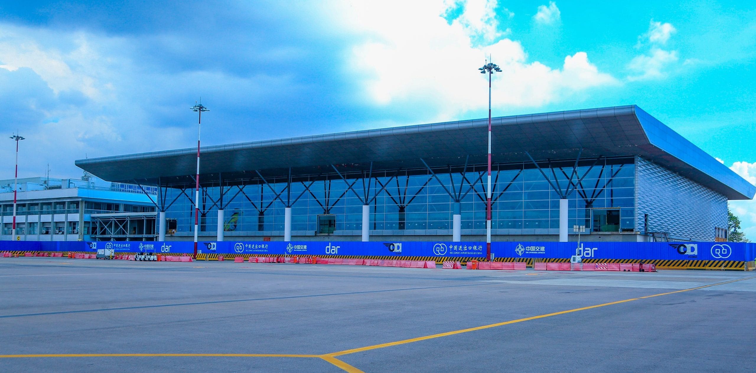
- Entebbe International Airport (HUEN/EBB): The main international hub, located near Kampala, handling the majority of passenger and cargo traffic.
- Arua Airport (HUAR/RUA): Serving northern Uganda with scheduled domestic flights.
- Gulu Airport (HUGU/ULU): An upgraded domestic hub with a long asphalt runway, supporting northern connectivity.
- Moyo Airport (OYG): Provides scheduled passenger service in the West Nile sub-region.
Other Key Airports and Airstrips in Uganda
Uganda also hosts a wide range of regional airports and airstrips, serving tourism, trade, and private aviation:
- Soroti Airport (HUSO/SRT): Formerly an aviation training hub, with one asphalt runway.
- Kasese Airport (HUKS/KSE): Serves the tourism corridor near Rwenzori Mountains and Queen Elizabeth National Park.
- Kisoro Airport (HUKI): Provides access to Bwindi Impenetrable Forest, popular with gorilla trekking tourists.
- Pakuba Airfield (HUPA/PAF): Located inside Murchison Falls National Park.
- Bugungu Airstrip & Chobe Airstrip: Both inside Murchison Falls Park, supporting safari lodges and charter flights.
- Mweya Airstrip: Serving Queen Elizabeth National Park.
- Kidepo Airport: Provides access to Kidepo Valley National Park, a remote safari destination.
- Mbarara Airport (HUMA/MBQ): Also known as Nyakisharara, supporting southwestern Uganda.
- Nakasongola Airport: A key facility with a long asphalt runway, also serving military functions.
- Jinja Airport (HUJI/JIN): Serving eastern Uganda and the city of Jinja.
Other smaller airstrips include Fort Portal, Lira, Moroto, Nebbi, Kotido, Kabale, Kajjansi (private), Kakira, Mutukula, Patongo, and Ishasha River Camp near the Congo border.
Role of Airports in Uganda’s Economy and Tourism
The list of airports in Uganda highlights their strategic importance for:
- Tourism: Providing access to wildlife parks like Bwindi, Kidepo, Queen Elizabeth, and Murchison Falls.
- Domestic travel: Connecting remote northern, eastern, and western towns with the capital.
- Trade and security: Supporting cargo movement and regional military logistics.
- International connections: Entebbe International Airport links Uganda to Africa, the Middle East, Europe, and Asia.
Airports in Uganda
| City served | Region | ICAO | IATA | Airport | Coordinates | Elev. (m) | Rwy. (m) | Surface |
|---|---|---|---|---|---|---|---|---|
| Adjumani | Northern | HUAJ | – | Adjumani Airport | 03°20′21″N 31°45′53″E | 796 | 1,131 | Unpaved |
| Arua | Northern | HUAR | RUA | Arua Airport | 03°02′50″N 30°54′44″E | 1,204 | 1,707 | Unpaved |
| Bugungu | Western | HUGG | – | Bugungu Airstrip | 02°12′10″N 31°33′16″E | 753 | 1,540 | Unpaved |
| Bundibugyo | Western | HUBU | – | Bundibugyo Airport | 00°40′15″N 30°01′35″E | 3,100 | 965 | Grass |
| Entebbe | Central | HUEN | EBB | Entebbe International Airport | 00°02′33″N 32°26′37″E | 1,153 | 3,658 / 2,408 | Asphalt |
| Gulu | Northern | HUGU | ULU | Gulu Airport | 02°48′20″N 32°16′18″E | 1,070 | 3,144 | Asphalt |
| Jinja | Eastern | HUJI | JIN | Jinja Airport | 00°27′11″N 33°11′34″E | 1,175 | 1,800 | Unpaved |
| Kabale | Western | HUKB | – | Kabale Airport | 01°13′34″S 29°57′36″E | 1,820 | 2,408 | Unpaved |
| Kajjansi | Central | HUKJ | – | Kajjansi Airfield | 00°11′48″N 32°33′09″E | 1,180 | 1,100 | Unpaved |
| Kakira | Eastern | HUKK | – | Kakira Airport | 00°29′56″N 33°16′57″E | 1,200 | 1,278 | Asphalt |
| Kasenyi | Western | HULA | – | Kasenyi Airport | – | 930 | – | Unpaved |
| Kasese | Western | HUKS | KSE | Kasese Airport | 00°10′59″N 30°06′05″E | 959 | 1,570 | Unpaved |
| Kidepo | Northern | HUKD | – | Kidepo Airport | 03°43′09″N 33°45′15″E | 1,190 | 1,280 | Unpaved |
| Kihihi | Western | – | KHX | Savannah Airstrip | 00°43′10″S 29°42′00″E | 1,100 | 2,000 | Gravel |
| Kisoro | Western | HUKI | – | Kisoro Airport | 01°16′48″S 29°43′09″E | 1,890 | 1,300 | Asphalt |
| Kitgum | Northern | HUKT | – | Kitgum Airport | 03°16′43″N 32°53′24″E | 929 | 1,900 | Unpaved |
| Kotido | Northern | HUKO | – | Kotido Airport | 02°57′06″N 34°07′21″E | 1,180 | 1,600 | Unpaved |
| Lira | Northern | HULI | – | Lira Airport | 02°14′52″N 32°54′35″E | 1,091 | 846 | Unpaved |
| Masindi | Western | HUMI | KCU | Masindi Airport | 01°45′29″N 31°44′12″E | 1,173 | 2,042 | Unpaved |
| Matany | Northern | – | – | Matany Airstrip | 02°26′58″N 34°23′45″E | 3,895 | 960 | Dirt |
| Mbarara | Western | HUMA | MBQ | Mbarara Airport (Nyakisharara International) | 00°33′19″S 30°35′58″E | 1,402 | 1,635 | Unpaved |
| Moroto | Northern | HUMO | – | Moroto Airport | 02°30′18″N 34°35′41″E | 1,280 | 1,500 | Unpaved |
| Moyo | Northern | – | OYG | Moyo Airport | 03°38′57″N 31°45′54″E | 980 | 1,160 | Unpaved |
| Murchison Falls NP | Northern | HUGG | – | Bugungu Airstrip | 02°12′08″N 31°33′16″E | – | – | Unpaved |
| Murchison Falls NP | Northern | – | – | Chobe Safari Lodge Airport | 02°14′25″N 32°08′30″E | 3,140 | 1,555 | Gravel |
| Mutukula | Central | – | – | Mutukula Airport | 00°55′30″S 31°27′00″E | 1,190 | 2,700 | Unpaved |
| Mweya | Western | HUMW | – | Mweya Airport | 00°11′34″S 29°53′45″E | 980 | 1,254 | Unpaved |
| Nakasongola | Central | – | – | Nakasongola Airport | 01°25′12″N 32°28′12″E | 1,100 | 3,000 | Asphalt |
| Namulonge | Central | HUNA | – | Namulonge Airport | 00°30′51″N 32°37′48″E | 1,180 | 560 | Unpaved |
| Nebbi | Northern | – | – | Nebbi Airport | 02°30′49″N 31°07′57″E | 900 | – | Unpaved |
| Patongo | Northern | – | – | Patongo Airfield | 02°45′43″N 33°19′02″E | 1,027 | 1,200 | Unpaved |
| Murchison Falls NP | Northern | HUPA | PAF | Pakuba Airfield | 02°19′35″N 31°29′52″E | 721 | 1,760 | Unpaved |
| Queen Elizabeth NP | Western | – | – | Ishasha River Camp Airport | 00°36′50″S 29°39′55″E | 3,140 | 1,006 | Gravel |
| Soroti | Eastern | HUSO | SRT | Soroti Airport | 01°43′39″N 33°37′22″E | 1,110 | 1,900 / 770 | Asphalt |
| Tororo | Eastern | HUTO | TRY | Tororo Airport | 00°40′48″N 34°10′05″E | 1,170 |
Conclusion
The airports in Uganda form a crucial transport backbone for a landlocked country. While Entebbe International Airport remains the primary gateway, regional airports like Gulu, Arua, Soroti, Kasese, Kisoro, and Pakuba extend access to tourism, trade, and local communities. Together, these airports strengthen Uganda’s role as a vital hub for East African travel and economic growth.


